Tuesday, 26 July 2011

Athabasca Glacier


The road from Lake Louise to the Icefields Explorer
The road from above
Tricia on ice - as thick as the Eiffel Tower is tall! Glacial ice is the result of densely packed snow rather than freezing water.
Mountains to the South east
It snowed during our glacier walk
A small stream of icy water flowed the length of the glacier. There were small pieces of volcanic ash in the water that had found their way to the glacier by air. 
Very cold water
This is not the Penguin Plunge!
Mountains to the west
Modern transportation
Glacier tourism circa 1950
Edge of the glacier (standing on a moraine). Each year the glacier makes a new "terminal moraine" which shows how long it became, as the lateral moraines build up on the sides. Under these moraines are even more ice!
Mt. Snowdome, so named as the peak is covered in snow year-round.
View from the tourism center patio


Thursday, July 21st

The Columbia Icefields covers 325 km^2 and stretches from Banff to Jasper. It consists of 8 major glaciers including the Athabasca Glacier, which we visited. Google image search 'Athabasca Glacier, Alberta, Canada'

Moraine Lake

Logs jammed at the bottom of Moraine Lake next to the Rock Pile
The Rock Pile stands today as it was discovered over 100 years ago
Tricia preparing for her ascent
View from the top. This view used to grace the back of the $20 bill. I had to climb over a guard rail and several slippery rocks to get here (don't tell mom)
Us near the top of the Rock Pile
Log jam from above
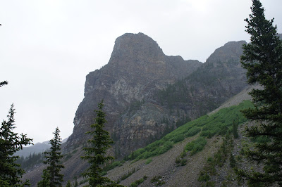
Tower of Babel. Good climbers make it up in 8 hours, bad climbers make it down in 10 seconds.
Rain on Moraine Lake 
My lovely wife isn't afraid of the rain - she insisted we go for a 2 hour hike.
All our words from loose using have lost their edge. - Hemmingway
A view from the far end of Moraine Lake 
Indian Paintbrush in the rain
A taste of things to come. Our next stop was the Athabasca Glacier.
Thursday, July 21st

Samuel Allen was the first European to visit in 1894 calling Moraine a "dark and gloomy lake". It was later named "Moraine" by Allen's associate Walter Wilcox (moraines are mounds of sediments and rocks deposited by glaciers). Wilcox  described the view from the Rock Pile, "no scene had ever given me an equal impression of inspiring solitude and rugged grandeur" and added that contemplating the view was the happiest half hour of his life. Moraine is only 15 minutes away from Louise, but the locals insisted that it was the better of the two. We couldn't comprehend any scale of comparing such beautiful places. We visited the dark and gloomy lake on July 21, 2011.

Saturday, 23 July 2011

Lake Louise

This photo was taken from the car window. It was such an amazing drive!
On the Bow Valley Parkway, en route to Lake Louise

Our hotel upgraded us to a loft! It had 2 full bathrooms, and slept 8 - including this murphy bed! We turned one bedroom into a "luggage room." It also was next to the tea house, Pete wasn't sure if Tom was our neighbor :)

We ate at the Deer House on the way to the lake, where we enjoyed Elk Ribeye. It was so delicious! Don't worry, it wasn't the same one that crossed the road on the Bow Valley Parkway.

We made it just in time for a canoe rental!

I let Pete take care of most of the paddling...  

         
....Which explains why we didn't make it very far      
The water is so clear, it makes you want to jump in! That might be a little cold, seeing as it's 32-35F. The water's color is due to "rock flour" that comes from glacial melt. It's so lightweight, it never settles to the bottom, and causes sunlight to reflect the beautiful blue-green color.
Panoramic view of the Fairmount Lake Louise

We decided to go to the Fairmount's Saloon (one of their many restaurants) and enjoy dessert from our high back chairs.

Banana split, brownie sundae, and hot cider with a cinnamon stick! They even wrote "Congratulations" on caramelized sugar cookies. As a former dessert girl, I was quite impressed.

Antlers were everywhere. On the walls...

...chandeliers...

And even my head!!


Thursday, July 21st

Johnston Canyon

We took the very scenic Bow Valley Parkway to Johnston Canyon
Along the way, we saw the remnants of a prescribed burn of the forest from 1993. They are necessary for healthy forest growth!
The canyon was quite deep!
But at other times, not deep enough!

The catwalk extended for several kilometers (or miles, for you Americans)
There were waterfalls around every bend
The Lower Falls - we crawled through the tunnel on the right for a closer look!

A BEAR! Oh wait, that's just my husband. This photo makes the cave look much larger than it actually was.

A view from the cave - it was too wet to take the camera out on the cliff!

The path went through the forest
...where we found some very friendly creatures. Note how close this ground squirrel is to Pete's boot! He followed us for quite a while hoping for some free snacks.
We didn't let a little (or a lot) of rain slow us down!
The spectacular Upper Falls

Suspended over the Johnston Creek by a 12' cantilever sticking out of the canyon wall.
We're lucky to have such great views on our honeymoon!
The company isn't bad, either :)


Wednesday, July 20th

Johnston Canyon is about 45 minutes north of Banff, so we stopped there on our way to Lake Louise. The ride was beautiful - we opted to take the scenic Bow Valley Parkway instead of the Trans Canadian Highway. It seemed impossible that anything could be more scenic than the Trans Canadian, but Bow Valley was! It was similar to taking Route 17 through New York, but the Rockies were surrounding us, and we had to stop for a male elk! Of course, in all the excitement, I couldn't get the camera to focus, but we knew that wouldn't be the last wildlife we'd see!

Johnston Canyon is set in an evergreen forest, and it is very moist - it started to rain as soon as we got there, but we had lots of layers packed in our backpacks, so we kept on trekking! Every turn in the trail was different from the last, and we couldn't stop snapping pictures! About half of the time is spent on a trail, and the other half on a catwalk in the canyon.

The two main attractions are the Lower Falls and Upper Falls. At the lower falls, there is a tunnel cut into the rock (partly by nature, with the floor somewhat smoothed out by mining tools). If you crawl through the tunnel, you can stand on a small cliff wall and get soaked by the waterfall's spray! It's amazing.

The Upper Falls are quite tall, and we viewed them both from below, on a suspended catwalk over the creek, as well as above. It's a beautiful sight. The rain kept a lot of other tourists away as well, so it really worked in our favor.

If you continue 4km past the Upper Falls, you'll reach the Inkpots, which are worth Google-ing for a view. We can't show you any pictures, because we got lazy and decided it was time to turn around at the Upper Falls, and head for dinner in Lake Louise!!